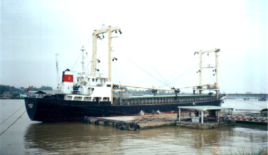
Dong Nai Port

GO DAU PORT INFORMATION
1/ ACCESS CHANNEL:
- Access river:: Thi Vai river
- Access channel length: 28 miles long from Vung Tau anchorage point
- Channel depth: 7.20 m on lowest tide
- Average tidal range: 3,40 m
- Tidal regime: irregular diurnal
- Navigation time: 24/24
-Port location:
10037’08”N-107001’26”E
2/ WHARVES :
Go Dau is ocean - trade port, consists of:
* KA:
- Wharves length: 250.00 m
- DWT capacity: 15,000 DWT
- Vessel' LOA have been accepted: 280 m
- Infront wharves water depth: 9.5 m
* KB1
- Wharves length: 74.00 m
- DWT capacity: 6.500 DWT
- Vessel' LOA have been accepted: 120,00 m
- Infront wharves water depth: 8.0 m
* KB2
- Wharves length: 120.00 m
- DWT capacity: 12,000 DWT.
- Vessel' LOA have been accepted: 140,00 m
- Infront wharves water depth: 9.0 m
* KB3
- Wharves length: 105.00 m
- DWT capacity: 20,000 DWT.
- Vessel' LOA have been accepted: 140,00 m
- Infront wharves water depth: 9.5 m
3/ OPEN STORAGE - FACILITIES:
- Open yard: 168,000 m2
- Ware-house: 8.100m2
- Shore crane: 12 units from 25 - 100 tons lifting capacity
- Automatic grab of 4.5 m3 capacity: 14 units
- Kinds of truck: 60 units
4/ HANDLING RATE:
- Bulk cargo: 1000 - 1500 tons/ gang/ day of 24 h working ( ship gear used )
- Bagged cargo: 600 tons/ gang/ day of 02 shifts working
- General cargo: 1.000 tons/ gang/ day of 02 shifts working
5/ WORKING TIME:
Port will service 24/24 if be necessary without over time and Sunday, holiday extra fees
- Supplied fresh water by pipe line and hose at wharves
- Supplied bunker, provision and others.
Ho Chi Minh city port (river port)
Pilot station position:10 Deg 17.04”3 N, 107 Deg 05.17” E
Ports: Nha Rong, Khanh Hoi, Tan Thuan, Ben Nghe, Lotus, Nhabe, Catlai...
Vungtau port area (seaport)
Pilot station position:10 Deg 17.04”3 N, 107 Deg 05.17” E
Ports: Go Dau, Phumy ports, Caimep ports, Vietsovpetro, PTSC.
Danang port area (seaport)
Pilot station position: 16 Deg 10N; 108 Deg 11E
Ports: Song Han, Tien Sa, My Khe, Lien Chieu
Haiphong port area (river port)
Pilot station position: 20 Deg 40N; 106 Deg 51E
Ports: Dinh Vu, Thuong Ly, Chua Ve, Doan Xa
Cai Lan Port
Pilot station: L' Orange Island, Lat. 20o43' 4''N, Long. 107o10' 3''E
Pilot boards about 0.5NM at the South of L'Orange Island, VHF contact CH.16
Pilotage: Distance from Pilot station to the port: 21 miles