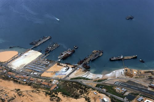
Cam Ranh Port
|
INFORMATION OF CAMRANH PORT (EX.BANGOI PORT) |
|
|
A. PORT CHANNEL |
|
|
1. Min. Depth below chart datum |
09.20 m. |
|
2. Min Width |
80.00 m. |
|
3. Quality of Bottom |
Sand and mud |
|
4. Required UKC |
0.50 m |
|
5. Dredging plan & maintenance |
One for every 3-5 year |
|
B. TURNING BASIN |
|
|
1. Location |
In front of the Pier |
|
2. Diameter |
417 x 244 m |
|
3. Min. Depth below chart datum |
12.00 m |
|
4. Quality of bottom |
Sand and mud |
|
5. Required UKL |
0.50 m |
|
C. ANCHORAGE |
|
|
1. Location |
11o 53'N - 109o 10'E |
|
2. Area L & B |
Off the pier: 2-3 miles |
|
3. Depth |
13 – 15 m |
|
4. Quality of Bottom |
Sand and mud |
|
D. NAVIGATION AID |
|
|
1. Channels buoys |
Yes |
|
2. Beacon |
01 at pilot station |
|
3. Transit Marks |
Nil |
|
4. Others |
|
|
E. PILOTAGE |
|
|
1. Number of Pilot |
06 prs |
|
2. Pilot Station - Port Entry Instruction: |
11o48' 30”N - 109o 12’30” E (First to: 11.46’52”N;109.31’48”E , then to 11.46’52”N;109.12’30”E, and then to P/stn) |
|
3. Service hours |
Day time only. |
|
4. Communication between pilot and vsl |
VHF – Channel 16 |
|
5. Maneuvering methods in the harbor |
Manual |
|
F. TUGBOAT |
|
|
1. Number of tug boat |
02 tug boats |
|
2. Type & Horse Power |
01 tug 1500hp; 01 tug 960 hp. |
|
3. Tower Rope |
Vessel’s rope |
|
4. Where making fast tugs when entering & dismissed when departure |
Tug always standby at the port |
|
5. Criteria for numbers of tugs for vsl entry & departure : depends on ship’sLOA |
|
|
6. Install VHF on Tug boat or not |
Yes, VHF installed on tug boats |
|
7. Operating Criteria |
Wind under 5th force |
|
8. Owner & Operator |
CAMRANH PORT 09 Nguyen Trong Ky, Cam Ranh,Vietnam Tel:84-58.3854 565 ; Fax: +84.58.3854 536 |
|
H. BERTH FACILITY |
|
|
1. Name of berth |
Camranh (Ex Bangoi) |
|
Max allowable size and approach speed DWT |
Max Draft : 12.60 m.. Vessel upto 50,000 DWT. |
|
Length / Breadth/ Depth. |
- 182.00 / 20.00 / 11.60m (30000dwt) - 180.00/20.00/13.30m (50000dwt) - 120.00 / 20.00 / 07.00 m (5000dwt)
|
|
Depth |
|
|
Speed |
Pilot’s order |
|
2. Water depth below mean L.W. springs |
|
|
3. Required UKC |
0.30m |
|
4. Length |
|
|
5. Width of Apron |
|
|
6. Height of deck level above O.D |
3.50 |
|
7. Max size of vsl ever accommodated |
49,900DWT |
|
8. Fender Type and materials |
Rubbers |
|
Number & interval |
|
|
9. Mooring Bit |
Steel |
|
10. Berth available & occupancy |
|
|
11. Priority System |
Pax ship → Container ship → Cargo ship |
|
12. Availability of fresh water |
Shore pipe |
|
13. Bunker supply |
at berth and at anchorage. |
|
14. Installation of docking sonor |
|
|
15. Water gravity (density) |
1.022 |
|
16. Restriction |
Max Draft : 11.20 m.. Vessel upto 50,000 DWT. |
|
I. LOADING CAPACITY |
|
|
Type and number of loader |
By ship’s gears or Shorecranes: 06 (15 - 45mts capacity) or 01 shore loader for woodchip only. |
|
Clear height from chart datum |
|
|
Out reach from fender face |
|
|
Traveling range |
|
|
Loading capacity |
Gen.Cargo: 150 mts/gang-shift ( 6hrs) Sand in bulk: 500 mts/gang-shift (6,000 mts/day) Woodchips: abt 3,500 mts/day |
|
Communication system between vsl and loading operator |
Foremen onboard or mobile phone or VHF |
|
J. COMMUNICATION |
|
|
Address |
VOSA Nhatrang 94 Hoang Dieu, Nha trang, Vietnam. Tel:84-58.3880969 ; Fax: 84-58.3880979 E.mail: vosant@dng.vnn.vn |
|
Items of necessary information |
Agent should be Informed in advance: - Ship’Particulars,DraftA/F,crew, passengers (if any), cargoes, ISPS Declaration - ETA Notice should be informed 3/2/1 days and 06 hrs prior to arrival at P/stn. |
|
Communication between vsl and port |
VHF, mobile phone |
|
K. QUARANTINE |
|
|
Availability of radio pratique system |
Through ship’s Agent |
|
Quarantine station |
As Pilot station |
|
Service hours |
Comprehensive hours |
|
Necessity Document |
Health Declaration Yellow Books of Crew Deratting Exemption Certificate |
|
L. CUSTOM AND IMMIGRATION |
|
|
Place where officers boarding |
Nil |
|
Service hours |
Comprehensive hours |
|
Documents |
General Declaration : 05 sets (Agent fom) Crew List: 07 sets Cargo Manifest: 03 sets Passenger List if any: 02 sets Health Declaration: 01 set Ship’s Store Declaration : 01 Crew Effects Declaration: 01 ISPS Declaration : 01 And others required by The Regulations |
|
This is updated by |
May 2013 |
Ho Chi Minh city port (river port)
Pilot station position:10 Deg 17.04”3 N, 107 Deg 05.17” E
Ports: Nha Rong, Khanh Hoi, Tan Thuan, Ben Nghe, Lotus, Nhabe, Catlai...
Vungtau port area (seaport)
Pilot station position:10 Deg 17.04”3 N, 107 Deg 05.17” E
Ports: Go Dau, Phumy ports, Caimep ports, Vietsovpetro, PTSC.
Danang port area (seaport)
Pilot station position: 16 Deg 10N; 108 Deg 11E
Ports: Song Han, Tien Sa, My Khe, Lien Chieu
Haiphong port area (river port)
Pilot station position: 20 Deg 40N; 106 Deg 51E
Ports: Dinh Vu, Thuong Ly, Chua Ve, Doan Xa
Cai Lan Port
Pilot station: L' Orange Island, Lat. 20o43' 4''N, Long. 107o10' 3''E
Pilot boards about 0.5NM at the South of L'Orange Island, VHF contact CH.16
Pilotage: Distance from Pilot station to the port: 21 miles