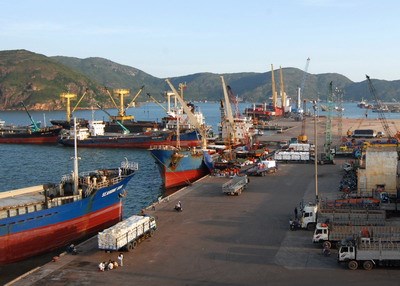
Quy Nhon Port
| PORT INFORMATION | ||
| Quynhon | Remarks | |
| 1/ Berth | No.1A, No.1B; No.1C, No.2, No.3 , No.4; Berth TCQN | |
| Lengh | No.1A + 1B + 1C: 350m/ No.2: 174m/ No.3: 174m/ No.4: 170m/ No.TCQN: 200m | |
| Depth | -7.8/7.8/7.8/8.9/8.9/11.80/12.50 | |
| Distance from P/S | 05 mile | |
| Max DWT vsls acceptable | 50000 | |
| Max draft | 8.5 m | |
| Yard area for general cargo | 153.000 m2 | |
| Container yard No.1 | 28,000m3 | |
| Container yard No.2 | 20,000m2 | |
| Warehouse area | 1500 m2 | |
| CFS area | 500m2 | |
| RF plugs/Voltage | No | |
| 2/ Facility | ||
| Mobile cranes 100Mt | 2 units | |
| cranes from 20-50mts | 10units | |
| cranes from 7-16mts | 5 units | |
| Floating crane/SWL | 0 | |
| Reachstackers/SWL | 07 units | |
| Computer weight station rated load 80mts | 03 station | |
| Folklifter/SWL | 14 units | |
| excavatator, bulldozers | 11 units | |
| Truck/Trailer/Chassis | 25/25/25 | |
| tugboats | 06 unts | HP800, HP980, HP 1020 |
| Other (if any) | HP 1000, HP 2,200 and HP 4200 | |
| Remark: | ||
| 1/ Port position: | ||
| Lacation: 13,46'N-109,14'E | ||
| Pilot station: 13,44'3N-109,15'0E | ||
| 2/ Tide regime: Irregular semi-diurnal | ||
| Max tide:2.20m, Min tide:0.5m | ||
Dong Nai Port
- Access river:: Thi Vai river
- Access channel length: 28 miles long from Vung Tau anchorage point
Cua Lo Port
1. Location: 180 50’ 2 N – 1050 42’ 2 E
2. Diameter: 250 m
3. Min. Depth below chart datum: 7.00 m
Nha Trang Port
1. Min. Depth below chart daum: 11.00
2. Min Width: 100.00
3. Quality of Bottom: Sand and mud
Vung Ang Port
1. Min. Depth below chart datum: -11.80m
2. Min Width: 150m
3. Quality of Bottom: Mud, Sand and some clay